This item has closed with no items sold
View the relisted Item
View other items offered by CapeCollectables1226

Similar products

Mpumalanga Provincial Map - Digital Download
R120.00
1961 Map of Europe, Excellent condition, Original McNally Map
R195.00
Rand McNally Map of Africa 1904 Digital Download
R295.00
1961 Map of North America, Excellent condition, Original McNally Map, Canada USA Mexico Greenland
R195.00
Rand McNally World and Oceans Map 1892 Digital Download Rand McNally World and Oceans Map 1892 Digital Download Rand McNally World and Oceans Map 1892 Digital Download Rand McNally World and Oceans Map 1892 Digital Download Rand McNally World and Oceans Map 1892 Digital Download Rand McNally World and Oceans Map 1892 Digital Download
Rand McNally World and Oceans Map 1892 Digital Download Rand McNally World and Oceans Map 1892 Digital Download Rand McNally World and Oceans Map 1892 Digital Download Rand McNally World and Oceans Map 1892 Digital Download
Rand McNally World and Oceans Map 1892 Digital Download
+2
Closed

Rand McNally World and Oceans Map 1892 Digital Download

Digital product
1 was available / new
R295.00
Shipping
This is a digital product (eg. voucher, product license, service, etc.) and does not require shipping. The seller will be in contact to deliver this product to you electronically.
The seller has indicated that they will usually have this item ready to ship within 3 business days. Shipping time depends on your delivery address. The most accurate delivery time will be calculated at checkout, but in general, the following shipping times apply:
 
Standard Delivery
Main centres:  1-3 business days
Regional areas: 3-4 business days
Remote areas: 3-5 business days
Buyer protection
Get it now, pay later

Product details

Condition
New
Location
South Africa
Area
Maritime
Time Period
1800s
Type
Political Map
Bob Shop ID
616822460

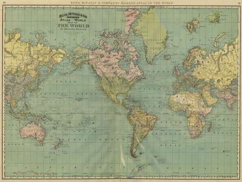
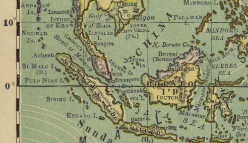
Title: Rand McNally World and Oceans Map 1892 Digital Download.
Map By: Rand McNally.
Publisher: Rand McNally & Company's Indexed Atlas of the World 1892.
Year Published: 1892.
Scale: @ 1: 40 000 000
File Type and Size:  JPG 14MB File Image.
Printed Size: Can be printed in up to A2, A1 and A0 Size.
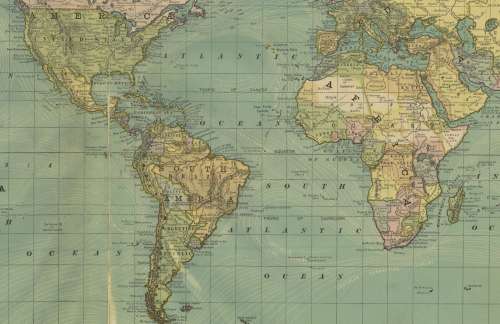
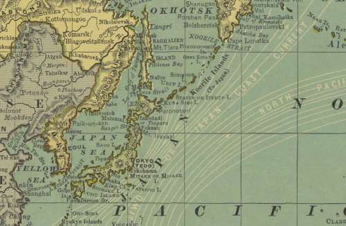
Info: Rand McNally & Company's Indexed Atlas of the World 1892, Map of the World On Mercator's Projection Showing The Direction Of The Oceans Current.
The map has North and South America in the centre.
Stephen S. Clark Library.
Condition: Digital Download.
Price: R 295.00.00 Inc Vat.


Please Note:  
On completion of the order a link will be forwarded to your e-mail address for downloading of the file.
Large image files require sufficient processing power and memory capabilities to render efficiently on the screen. 
Prior to printing please ensure that the printer has sufficient RAM for processing the image.


Recently viewed

See more
Tile roof P2000 channel mounting bracket - Truss connection
R95.00
0258006029 9636148880 1628HV Lambda O2 Oxygen Sensor For CITROEN PEUGEOT 206 1.4 301 307 308 406 ...
R459.00
Timing Belt Kit fit for 90-97 Accord 2.2L SOHC Non-VTEC F22A F22B Car Timing Tools
R1,157.00
Car LED Headlight headlamp for Audi Q3 13-16 Daytime Running DRL Turn signal
R15,268.00